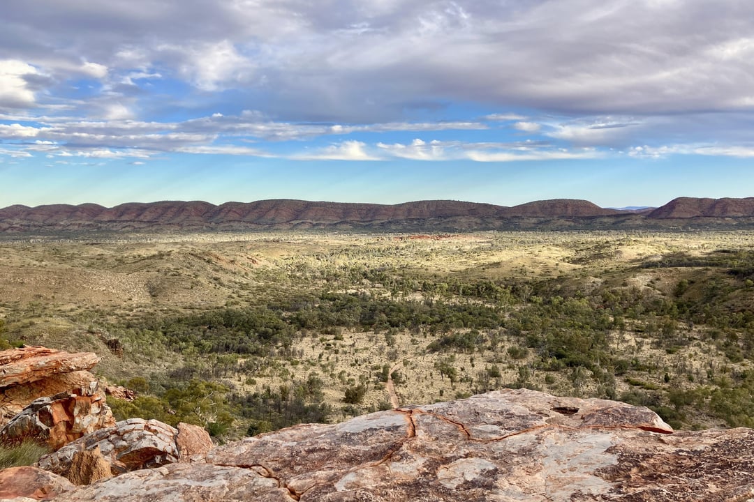
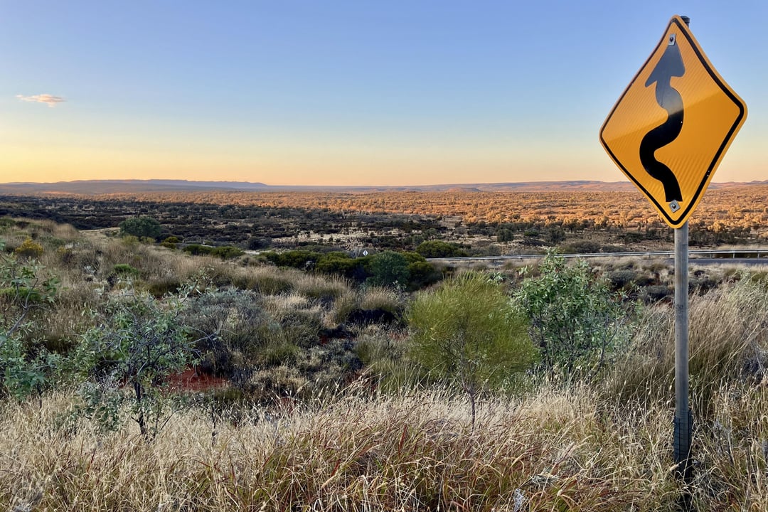
The southern half of the Northern Territory is a vast, almost featureless scrubland. Unless you’ve done this sort of remote riding before, you do not understand how incomprehensibly huge it is: the settlements are literally 300+ miles apart from one another. It’s the equivalent of riding from one end of Iowa to the other and encountering only three gas stations, not a joke. Most places have no cell service, but almost every rest area had bore water that could be used in an emergency. (You’d probably want to filter it, but it always looked clean to me.) And this was on the busiest stretch of the territory, via the Stuart Highway!
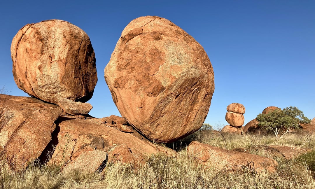
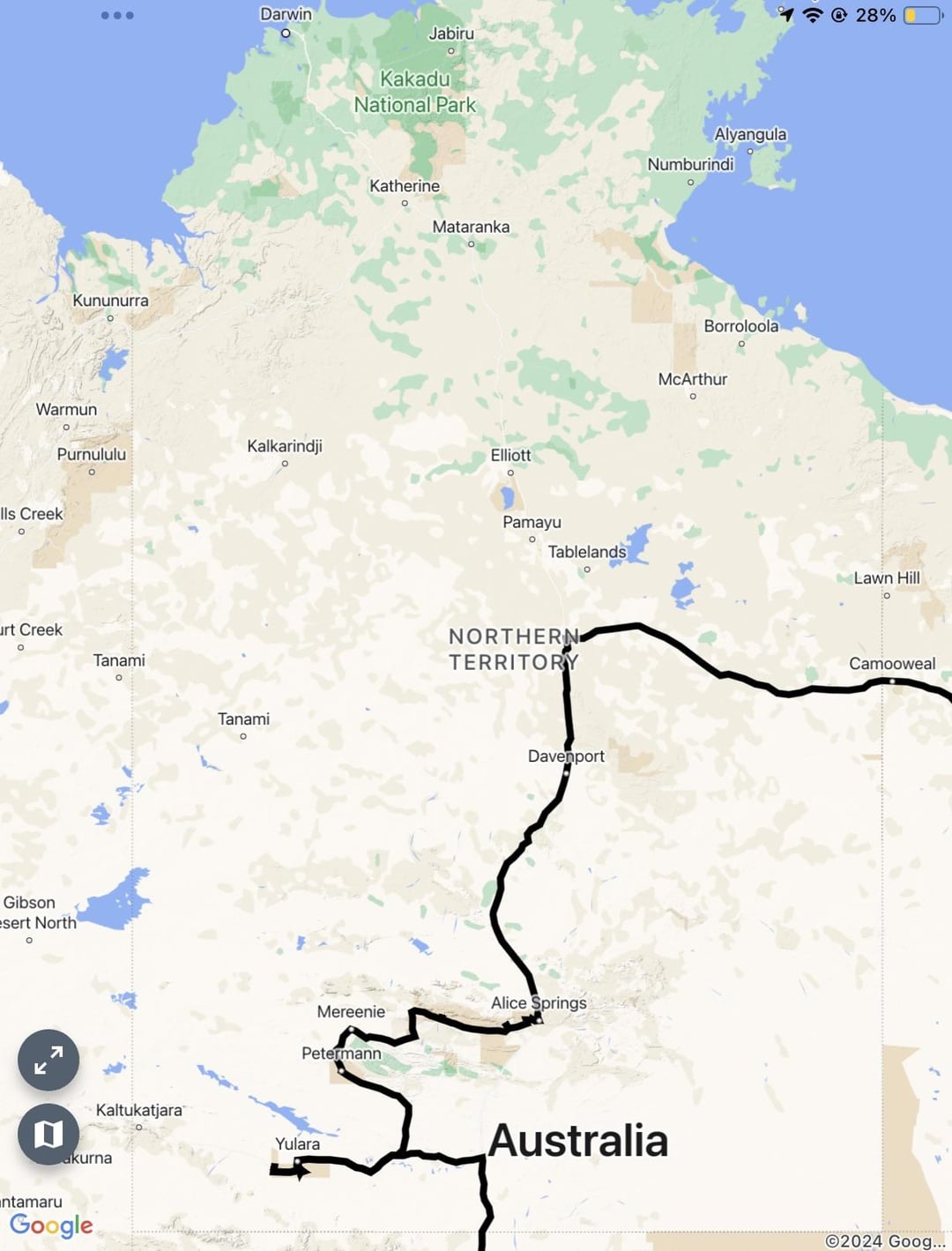
I rode in from Queensland via the Barkly Highway, which was probably the worst of all the riding I’ve done so far. It’s unusually lonely and a bit on the dilapidated side, with all of two roadhouses along a 500-km stretch. I passed through Tennant Creek and recharged before riding another 500 km to Alice Springs, camping at the Devil’s Marbles along the way. (Absolutely worth it, btw.) From here, things got interesting: a leisurely stroll through the West MacDonnells, then a torturously bumpy ride along the Mereenie Loop into Kings Canyon, where I let my saddle sores deflate and hiked around a bit, lol.
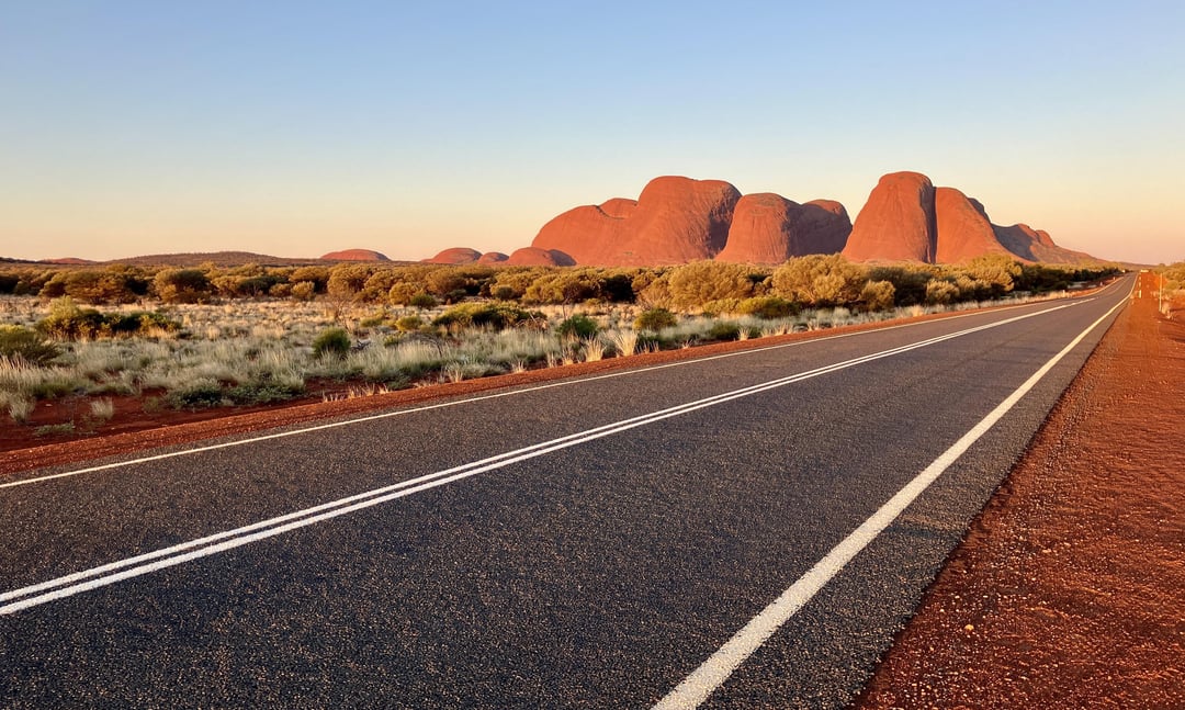
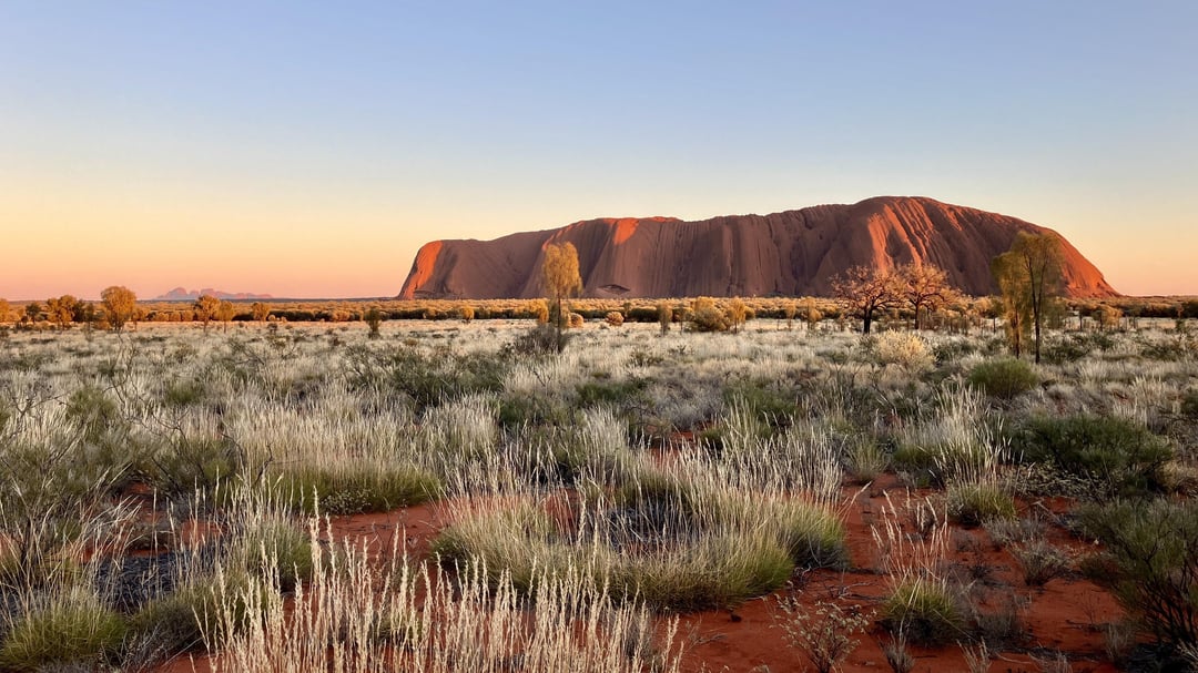
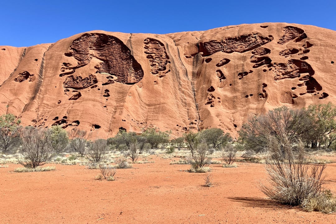
I then puttered into Yulara, the resort town that services Uluru/Ayers Rock, and toured the park over two days, camping on the far end near Kata Tjuta/The Olgas on the second day. (It’s a nearby second monolith that’s much less famous.) The scenery wasn’t as breathtaking as I was expecting, but the bike trail around Uluru was fun and the hiking around Kata Tjuta had a certain magical quality. I took another long break in Yulara, then stocked up for a six-day ride to the next town along the Stuart Highway—Coober Pedy, all the way in South Australia.
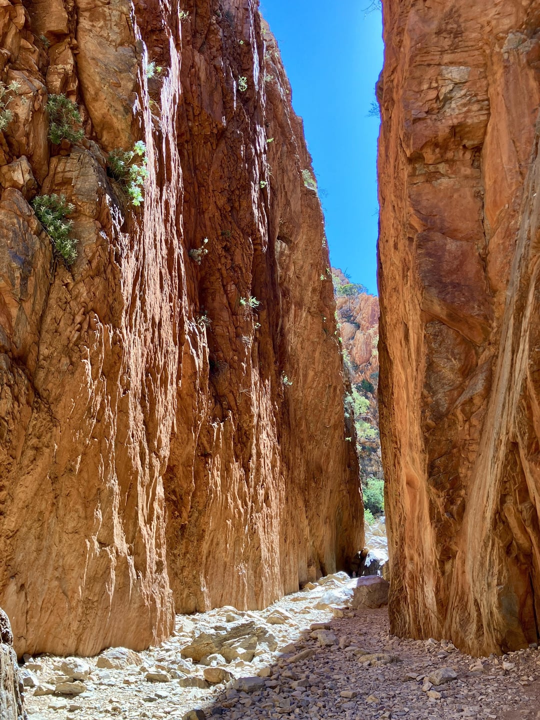
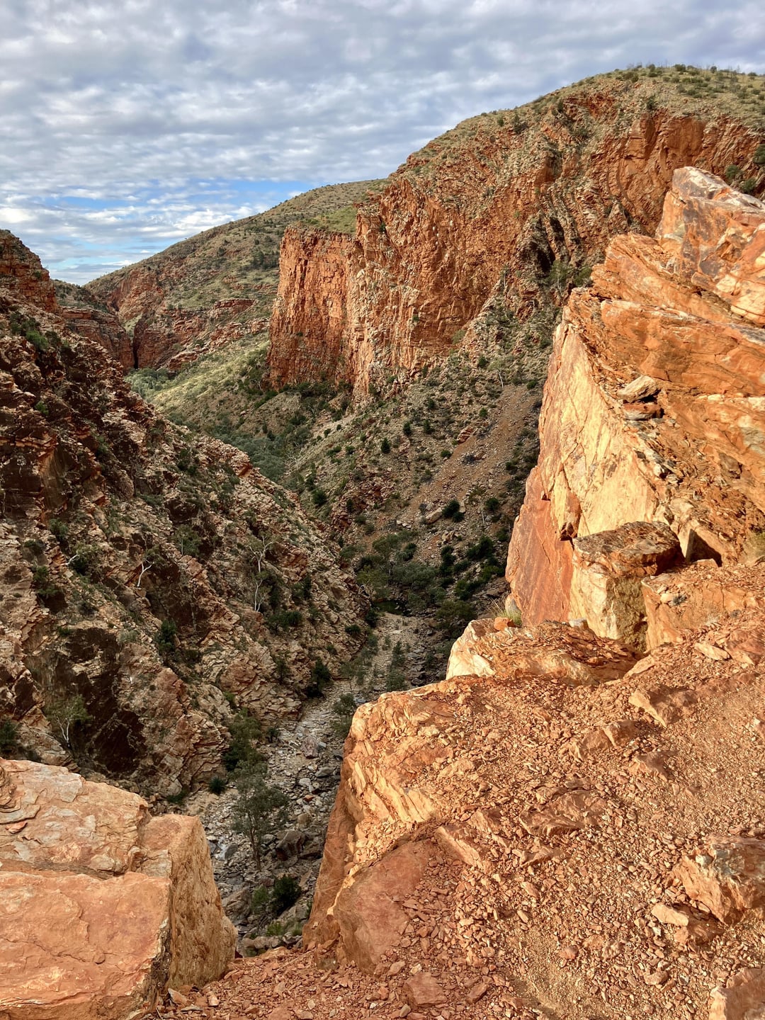
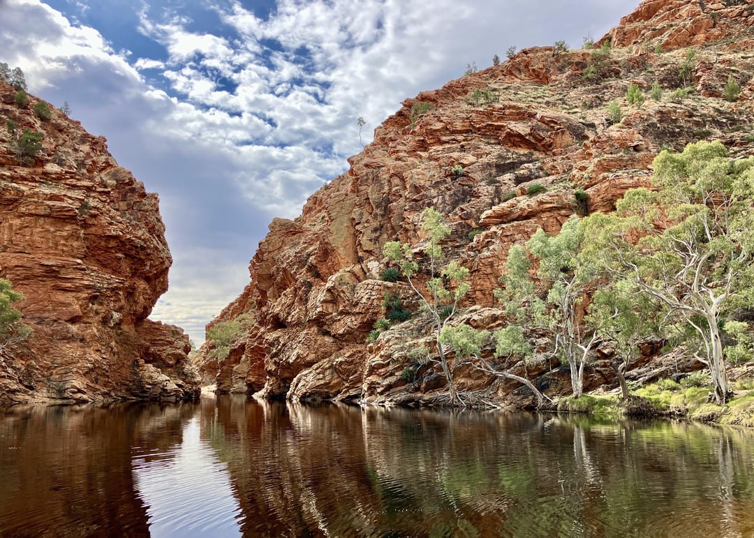
The MacDonnells were hands down the most beautiful scenery I’ve encountered out here. It’s a reef that stretches for hundreds of kilometers on either side of Alice Springs. There’s a gorge, chasm, canyon, or waterhole every twenty kilometers or so and there’s dozens of hikers milling about in the winter months as they traverse the Larapinta Trail. (They often leave free food behind at the trailheads since they pack more than necessary, which was a welcome perk.)
If I had anything to do over, I would have done a supply drop for one of the farthest gorges in the West MacDonnells. I think how it works is that hikers buy a bunch of food, put it in a standardized bin, and pay a company to ferry the bin to one of the dozen trailheads along the route. (It’s economical because they’re constantly bouncing people and supplies from one spot to the next, at least in winter.) You’ll want to concentrate your effort here and visit as many gorges as possible—most of them are only a few kilometers off the highway—but by the time you finish, you’ll be a two-day ride from the nearest town, hence the supply drop. (I had to book it to Kings Canyon to not starve to death, lol.)
If you ever want to experience the Outback by bicycle, but you don’t want to spend 25 days per month riding through never-ending scrubland just to see three tourist attractions, then do yourself a favor and fly straight to Alice Springs. You could do a two-week loop through the West MacDonnells, the Mereenie Loop, Kings Canyon, Yulara/Uluru, and then either take a bus or spend four days puttering back to Alice Springs to experience a dollop of the aforementioned featureless scrubland riding.
Some statistics: I rode just shy of 2,000 km over 29 days. Five of those were break days with zero riding. I spent 18 nights freedom camping, 8 nights at paid campgrounds, and three nights with a warmshowers host in Alice Springs. If the Outback has any perk, it’s that it’s ludicrously easy to wild camp, lol.

1 Comment
The southern half of the Northern Territory is a vast, almost featureless scrubland. Unless you’ve done this sort of remote riding before, you do not understand how incomprehensibly huge it is: the settlements are literally 300+ miles apart from one another. It’s the equivalent of riding from one end of Iowa to the other and encountering only three gas stations, not a joke. Most places have no cell service, but almost every rest area had bore water that could be used in an emergency. (You’d probably want to filter it, but it always looked clean to me.) And this was on the busiest stretch of the territory, via the Stuart Highway!
I rode in from Queensland via the Barkly Highway, which was probably the worst of all the riding I’ve done so far. It’s unusually lonely and a bit on the dilapidated side, with all of two roadhouses along a 500-km stretch. I passed through Tennant Creek and recharged before riding another 500 km to Alice Springs, camping at the Devil’s Marbles along the way. (Absolutely worth it, btw.) From here, things got interesting: a leisurely stroll through the West MacDonnells, then a torturously bumpy ride along the Mereenie Loop into Kings Canyon, where I let my saddle sores deflate and hiked around a bit, lol.
I then puttered into Yulara, the resort town that services Uluru/Ayers Rock, and toured the park over two days, camping on the far end near Kata Tjuta/The Olgas on the second day. (It’s a nearby second monolith that’s much less famous.) The scenery wasn’t as breathtaking as I was expecting, but the bike trail around Uluru was fun and the hiking around Kata Tjuta had a certain magical quality. I took another long break in Yulara, then stocked up for a six-day ride to the next town along the Stuart Highway—Coober Pedy, all the way in South Australia.
The MacDonnells were hands down the most beautiful scenery I’ve encountered out here. It’s a reef that stretches for hundreds of kilometers on either side of Alice Springs. There’s a gorge, chasm, canyon, or waterhole every twenty kilometers or so and there’s dozens of hikers milling about in the winter months as they traverse the Larapinta Trail. (They often leave free food behind at the trailheads since they pack more than necessary, which was a welcome perk.)
If I had anything to do over, I would have done a supply drop for one of the farthest gorges in the West MacDonnells. I think how it works is that hikers buy a bunch of food, put it in a standardized bin, and pay a company to ferry the bin to one of the dozen trailheads along the route. (It’s economical because they’re constantly bouncing people and supplies from one spot to the next, at least in winter.) You’ll want to concentrate your effort here and visit as many gorges as possible—most of them are only a few kilometers off the highway—but by the time you finish, you’ll be a two-day ride from the nearest town, hence the supply drop. (I had to book it to Kings Canyon to not starve to death, lol.)
If you ever want to experience the Outback by bicycle, but you don’t want to spend 25 days per month riding through never-ending scrubland just to see three tourist attractions, then do yourself a favor and fly straight to Alice Springs. You could do a two-week loop through the West MacDonnells, the Mereenie Loop, Kings Canyon, Yulara/Uluru, and then either take a bus or spend four days puttering back to Alice Springs to experience a dollop of the aforementioned featureless scrubland riding.
Some statistics: I rode just shy of 2,000 km over 29 days. Five of those were break days with zero riding. I spent 18 nights freedom camping, 8 nights at paid campgrounds, and three nights with a warmshowers host in Alice Springs. If the Outback has any perk, it’s that it’s ludicrously easy to wild camp, lol.