
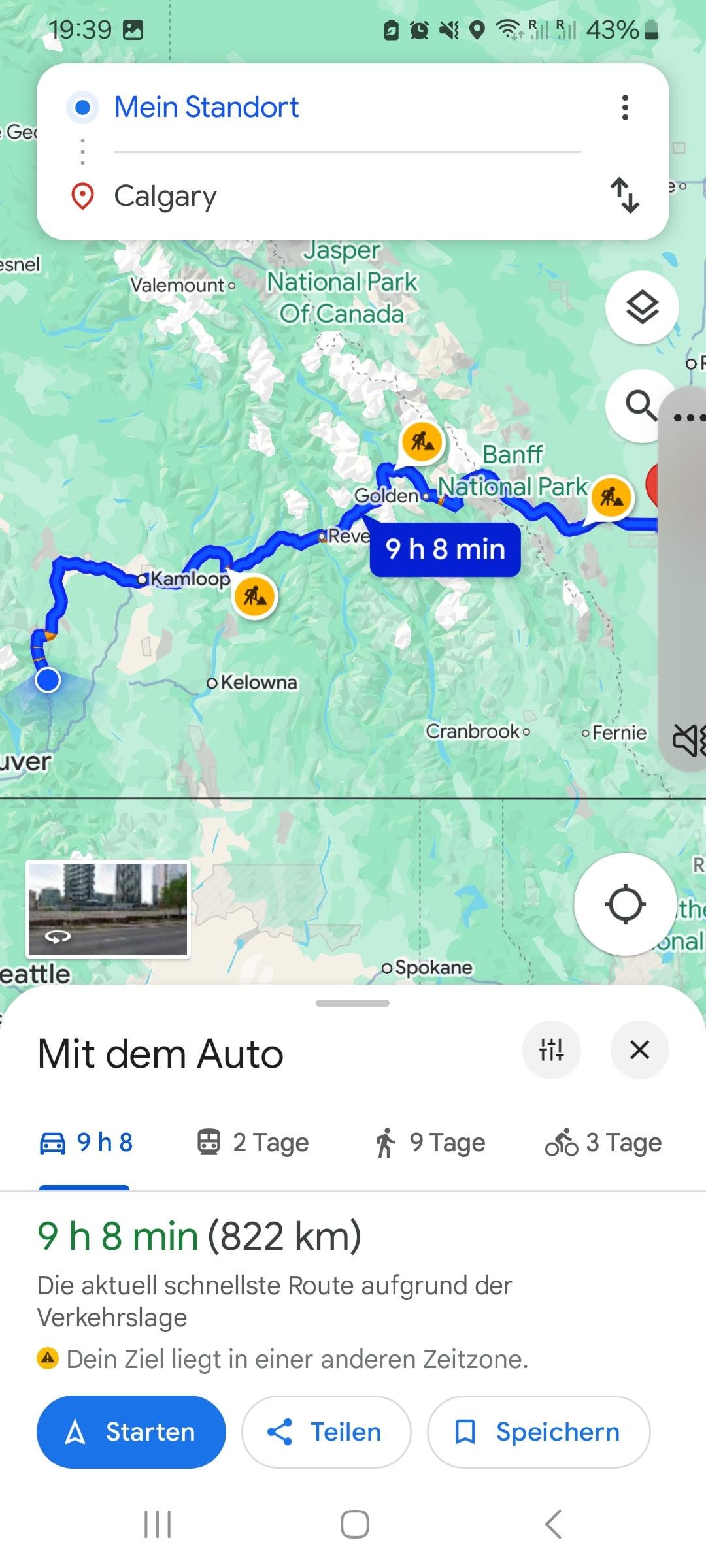
Hi guys! i'm currently cycling from Vancouver to Calgary, and most guys i've talked to said that the Trans-Canada Hwy 1 is a good route for that.
My question is, am i allowed to use the Hwy 1 all the way to Calgary? i tried to plan the route on Komoot and Google Maps and it always redirects me on certain points of the Hwy 1. Does the Hwy 1 turn to a Freeway on certain parts?
I hope some of you can help me out on that. 🙏🏻
by Guelicious
3 Comments
When are you planning on leaving? I just came out of the mountains down south in the states and some of the nights got down to like 2 or 3 degrees on some of the passes. Just be safe.
Another note. I just rode highway 3 this year and it was pretty good. A lot of good free camping. The Kettle Valley was worth riding but you need to be on at least 40s to enjoy it. Some parts, especially on the interior around Penticton was quite sandy. I never rode 1 but it’s probably busier than 3 and 3 has a decent shoulder for most of the ride.
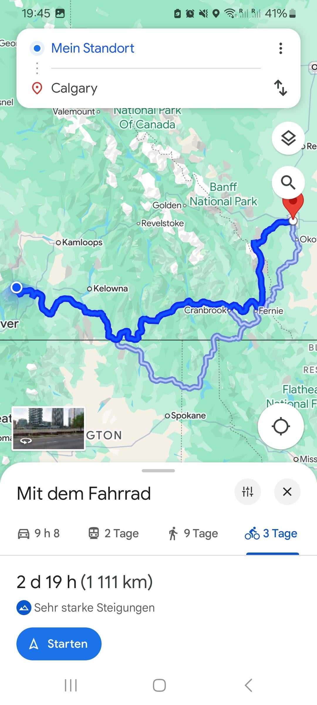
Looks like you are already up in Boston Bar, so are pretty committed to highway 1. The second photo has a route going on highway 3. That’s a better ride for the most part and much less traffic, but the google maps directions at the start are putting you over some really remote logging roads. It also brings you over the Elk Pass into Alberta at the end, which is a very beautiful bikepacking route, but would require wider tires.
In regards to legal cycling areas, here are the regulations on highway cycling in BC. Looks like the only part necessary to skip is the freeway through Kamloops. You will have to divert to side roads after the junction with highway 5. [https://www2.gov.bc.ca/gov/content/transportation/driving-and-cycling/cycling/cycling-regulations-restrictions-rules](https://www2.gov.bc.ca/gov/content/transportation/driving-and-cycling/cycling/cycling-regulations-restrictions-rules)
To finish to Calgary, take the Bow Valley parkway between Lake Louise and Banff, the Legacy trail to Canmore, then highway 1A (Bow Valley Trail) to Calgary. And do watch the weather. It has already snowed on some of the passes in BC this year.
If I understand [this](https://www2.gov.bc.ca/gov/content/transportation/driving-and-cycling/cycling/cycling-regulations-restrictions-rules) right
These are the areas of Hwy 1 restricted for bikes
*Trans-Canada Highway #1 — from the ferry terminal at Horseshoe Bay to the north approach to the Ironworkers Memorial Second Narrows Bridge; from its intersection with Rupert Street to its junction with Route #3 in Hope; from its junction with the Coquihalla Highway (Afton Interchange) on the west approach to Kamloops to its junction with the Yellowhead Highway on the east approach to Kamloops.*
Except
…*does not apply to pedestrians and to operators of pedal cycles and limited speed motorcycles using footpaths constructed adjacent to the travel portion of the highway or the shoulder on the travel portion of the highway where the minister causes signs to be erected designating the footpath or shoulder for such permitted use.*
I would prefer to ride the Trascanada trail of The BC Trail. I have pedalled almost all of the section you would have to do (Canmore to Hope on one trip, Canmore to Calgary as part of a different trip) and it is a nice ride as long as long as you have wide enough tires.
edit: link to [The BC Trail](https://bikepacking.com/routes/bc-trail/)